|
|
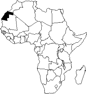
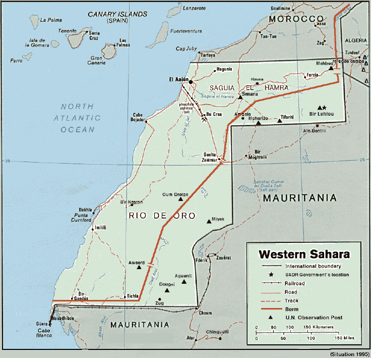
The Western Sahara includes Saguiet el-Hamra in the north and Wadi ed Dahab (Rio de Oro) in the south. Its area of 284 000 square Kilometers, is one tenth the size of Algeria, half the size of France and just a little smaller than Italy. It lies between the 20th and 30th parallel straddling the Tropic of Cancer. It is bordered to the north by Morocco, by Algeria to the east, Mauritania to the south-east and the Atlantic Ocean to the west.
As with most African states, its boundaries are the result of agreements made among the colonial powers anxious to safeguard their interest in the region. In particular, they were defined in agreements made between France and Spain in 1900, 1904 and 1912.
The topography is mostly made up of plains and some small plateaus that rarely reach 400 meters. On the whole, the Western Sahara can be divided into three regions :
1) The northeast zone from the chain of Atlas mountains to the hills of Zemmour is a rocky desert (hamadas) with steep mountains and a pronounced relief except for a few scattered wells.
2) The second zone is made up of rivers. It includes the wadi Draa to the north and the Jat to the west. These wadis are often depressions where water gathers during the brief rainy seasons, particularly in autumn. Because of the high temperatures the water quickly evaporated and never reaches the sea. In this river zone flows the Saguiat el-Hamra (the Red Canal) whose importance lends its name to the region. Sufficient vegetation for grazing grows along its banks and at Smara, barley and corn are cultivated.
3) The third zone, the Rio de Oro, is inland and consists of flat plains, ergs and sand dunes. The ground is too permeable to retain the autumn waters and too flat to allow it to flow, hence water accumulates in the subsoil forming numerous wells. The inland landscape is quite monotonous and along the coast this monotony is only broken by the peninsulas of Dakhla (ex-Villa Cisneros) and Guera. Inland, the climate is continental with cold, dry winters while summers are extremely hot with temperatures reaching 60° (in the shade) and the coastal humidity causing fog, mist and dew. Dakhla receives a yearly average rainfall of only 45 millimeters. On the coast, vegetation and flora is abundant due to the humidity.Inland, one finds the typical flora of the steppe and desert; some locusts along the wadis and shrubs in the sandy depressions. To the south, there is little fauna and to the southeast, it is mainly fennecs, antelope and gerbils.
>> Terrestrische Ressourcenpotentiale der Republik Westsahara, © Dipl.Geogr. Christoph M. Brenneisen
 [Land
and People, summary] [Western Sahara
Homepage]
[Land
and People, summary] [Western Sahara
Homepage]